
- GeoData
- » International development
| Date: | 2003 - 2006 |
|---|---|
| Project: | 111106 |
| Client: | World Bank |
Environmental Impact of deforestation and Poverty Mapping in Azerbaijan
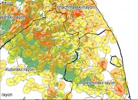
 Development of natural resource management models based upon utility reform, environment poverty mapping and the potential for deforestation in Azerbaijan. Substantial work was undertaken by the University of Southampton and the GeoData Institute to map forestry cover, map poverty at a community based level and develop a base map of key environmental parameters for the development and assessment of the model. The entire process was underpinned with GIS and database training over a number of missions to Azerbaijan. Poverty mapping in Azerbaijan is based upon the census. Potential for deforestation is based upon access to forestry, poverty and access to fuel. The work was conducted with staff from the World Bank